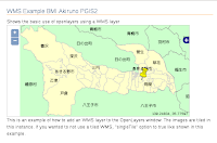
KML Layer Example(sundials.html)を参考に、KML の「説明」に入力した内容をポップアップ表示させます。
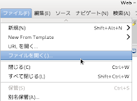
a メニューの「ファイル」->「開く」をクリックします。
b 「ファイルを開く」ウィンドウで、「OpenLayers-2.13.1」->「examples」->「sundials.html」をクリックして選択し、「OK」ボタンをクリックします。
c 「sundials.html」の内容の一部をコピーして「ol013-nippon_bmi_akiruno_pgis.html」に貼り付け、次のように修正します。
---
<script type="text/javascript">
 var map, layer0, layer1, layer2, layer3, layer4, select; // "select" 追加
---
  map.addLayer(kml_layer);
// ここから追加
//  select = new OpenLayers.Control.SelectFeature(sundials);
  select = new OpenLayers.Control.SelectFeature(kml_layer); // 修正
//  sundials.events.on({
  kml_layer.events.on({ // 修正
   "featureselected": onFeatureSelect,
   "featureunselected": onFeatureUnselect
  });
  map.addControl(select);
  select.activate();
// ここまで
  map.addControl(new OpenLayers.Control.LayerSwitcher());
  map.addControl(new OpenLayers.Control.MousePosition());
  map.zoomToMaxExtent();
 } // End of function(init)
// ここから追加
 function onPopupClose(evt) {
  select.unselectAll();
 }
 function onFeatureSelect(event) {
  var feature = event.feature;
// Since KML is user-generated, do naive protection against
// Javascript.
  var content = "<h2>"+feature.attributes.name + "</h2>" +  feature.attributes.description;
  if (content.search("<script") != -1) {
   content = "Content contained Javascript! Escaped content below.<br>" +  content.replace(/</g, "<");
  }
  popup = new OpenLayers.Popup.FramedCloud("chicken",
   feature.geometry.getBounds().getCenterLonLat(),
   new OpenLayers.Size(100,100),
   content,
   null, true, onPopupClose);
  feature.popup = popup;
  map.addPopup(popup);
 }
 function onFeatureUnselect(event) {
  var feature = event.feature;
  if(feature.popup) {
   map.removePopup(feature.popup);
   feature.popup.destroy();
   delete feature.popup;
  }
 }
// ここまで
</script>
---
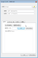
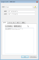
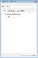
例えば、「Point.xml」の次の部分を修正するとポップアップに画像が表示されます。--- <Placemark> <name>Point</name> <description><![CDATA[あきる野市 Point<br /><img src="../img/marker.png" height="50" />]]></description> <LookAt> ---

