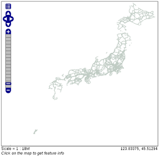
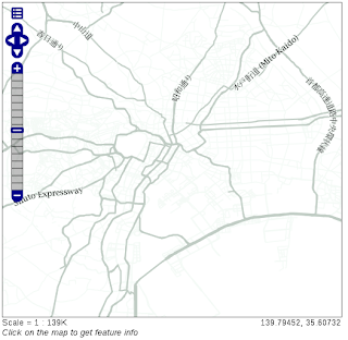
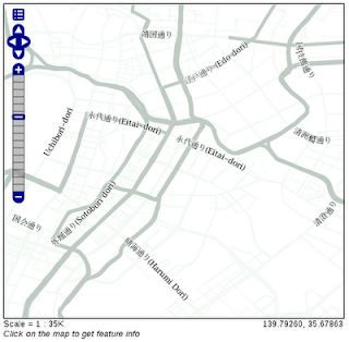
1 左側の欄の「Layer Preview」をクリックします。
2 「sde:japan_highway」の「OpenLayers」リンクをクリックします。
3 「wms を開く」ダイアログで「ファイルを保存する」を選択しボタンをクリックします。
wms の内容はつぎのようになっています。
<?xml version="1.0" encoding="UTF-8" standalone="no"?><!DOCTYPE ServiceExceptionReport SYSTEM "http://localhost:8080/geoserver/schemas/wms/1.1.1/WMS_exception_1_1_1.dtd"> <ServiceExceptionReport version="1.1.1" >   <ServiceException>
      The requested Style can not be used with this layer.  The style specifies an attribute of aeroway and the layer is: sde:japan_highway
</ServiceException></ServiceExceptionReport>
osm_roads スタイルの Runway のデータを削除します。
4 左側の欄の Data -> Styles をクリックします。
5 <!-- Runways from openstreetmap --> から
<-- end of zoom level b --> までを削除します。
(「japan_highway」の「Default Style」が「osm_roads」であることを確認します。)
6 左側の欄の「Layer Preview」をクリックします。
7 「sde:japan_highway」の「OpenLayers」リンクをクリックします。
OpenLayers は表示されましたが、つぎのようにエラーメッセージが表示されました。
The requested Style can not be used with this layer. The style specifies an attribute of highway and the layer is: sde:japan_highway
<NamedLayer> の <Name> を sde:japan_highway にします。<-1
<Rule> の <Name> を sde:japan_highway にします。これは表示に影響はない(?)と思います。<-2
<ogc:Filter> の <ogc:PropertyName> を type にします。<-3
---
<NamedLayer>
 <Name>sde:japan_highway</Name> <-1
  <UserStyle>
   <Title>A boring default style</Title>
   <Abstract>A sample style that just prints out a green line</Abstract>

   <!-- start of zoom level 3 -->

   <FeatureTypeStyle>
    <Rule>
     <Name>sde:japan_highway</Name> <-2
     <Title>freeways- outer zoom level</Title>
     <Abstract>freeways style openstreetmap data</Abstract>
     <ogc:Filter>
      <ogc:Or>
       <ogc:PropertyIsEqualTo>
        <ogc:PropertyName>type</ogc:PropertyName> <-3
        <ogc:Literal>residential</ogc:Literal>
       </ogc:PropertyIsEqualTo>
       <ogc:PropertyIsEqualTo>
        <ogc:PropertyName>type</ogc:PropertyName>
        <ogc:Literal>unclassified</ogc:Literal>
       </ogc:PropertyIsEqualTo>
      </ogc:Or>
     </ogc:Filter>
     <MinScaleDenominator>1000</MinScaleDenominator>
     <MaxScaleDenominator>4000</MaxScaleDenominator>
     <LineSymbolizer>
      <Stroke>
       <CssParameter name="stroke">#f4faf6</CssParameter>
       <CssParameter name="stroke-width">12</CssParameter>
       <CssParameter name="stroke-linejoin">round</CssParameter>
      </Stroke>
     </LineSymbolizer>
     <TextSymbolizer>
      <Label>
       <ogc:PropertyName>name</ogc:PropertyName>
      </Label>
      <Font>
       <CssParameter name="font-size">10</CssParameter>
       <CssParameter name="font-family">Arial</CssParameter>
       <CssParameter name="font-color">#eeeeee</CssParameter>
      </Font>
     <LabelPlacement>
      <LinePlacement>
       <PerpendicularOffset>
         0
       </PerpendicularOffset>
      </LinePlacement>
     </LabelPlacement>
     <Halo>
      <Radius>
       <ogc:Literal>1</ogc:Literal>
      </Radius>
      <Fill>
       <CssParameter name="fill">#f4faf6</CssParameter>
      </Fill>
     </Halo>
     <Fill>
      <CssParameter name="fill">#808080</CssParameter>
     </Fill>
     <VendorOption name="maxDisplacement">50</VendorOption>
     <VendorOption name="labelAllGroup">true</VendorOption>
     <VendorOption name="removeOverlaps">true</VendorOption>
     <VendorOption name="followLine">true</VendorOption>
     <VendorOption name="group">true</VendorOption>
    </TextSymbolizer>
   </Rule>
  </FeatureTypeStyle>
---
japan_highway の type の内容は次の通りです。
user@debian:~$ psql osm
Welcome to psql 8.3.9, the PostgreSQL interactive terminal.

Type:  \copyright for distribution terms
       \h for help with SQL commands
       \? for help with psql commands
       \g or terminate with semicolon to execute query
       \q to quit

osm=> SELECT distinct type from japan_highway;

           type
--------------------------
 bridleway
 construction
 crossing
 cycleway
 footpath
 footway
 incline,footway
 living_street
 minor
 motorway
 motorway_link
 pah
 pass
 path
 pedestrian
 primary
 primary; path
 primary_link
 raceway
 residential
 road
 runaway_truck_lane
 secondary
 secondary_link
 service
 services
 slope
 steops
 steos
 steps
 tertiary
 tertiary; secondary
 tertiary_link
 track
 trunk
 trunk_link
 unclass
 unclassified
 unclassified;residential
 undefined
 unsurfaced
(41 rows)

(END):
このうち、osm_roads.sld に設定されているものは次の通りです。
residential
unclassified
primary
secondary
tertiary
motorway
trunk
倍率によって、表示できる道路、線の太さ、色が変わるように設定されています。
「Layer Preview」をクリックして「sde:japan_highway」の「OpenLayers」リンクをクリックしてください。
最初の倍率では何も表示されません。


<VendorOption... は、
Throw GeoServer a curve (and it will be labeled)
http://blog.geoserver.org/2009/01/08/throw-geoserver-a-curve/
に説明があります。
これによってラベルが道路に沿って表示されます。

0 件のコメント:
コメントを投稿