
OpenLayers の Development Examples の「WFS Transaction Example(http://openlayers.org/dev/examples/wfs-protocol- transaction.html)」を参考に 描画したフィーチャを保存してみます。
GIS Tutor
http://www.gistutor.com
の
OpenLayers WFS-T Using a GeoServer Hosted PostGIS Layer
http://www.gistutor.com/openlayers/22-advanced-openlayers-tutorials/47-openlayers-wfs-t-using-a-geoserver-hosted-postgis-layer.html
も参考にしました。
GeoServer に新しいレイヤを作成します。レイヤは次のようにします。
Layer(Type) Name Default Style(WMS Setting)
vectors polygon
Workspace Store attribute Enabled? Declare SRS
npn bmi Multipolygon cheked EPSG:2451
Min X: Min Y: Max X: Max Y:
-63100 -34500 -45400 -24200
a Web ブラウザのアドレスバーに 「http://localhost:8080/geoserver/」と入力して Enter キーを押し GeoServer を開きます。
b 「Username」と「Password」を入力して「Login」ボタンをクリックします。
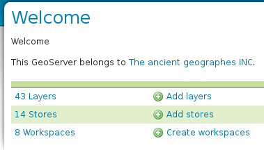 c 「Welcome」ページの「Add layers」をクリックします。
e 「New Layer」ページの「Create new feature type...」をクリックします。


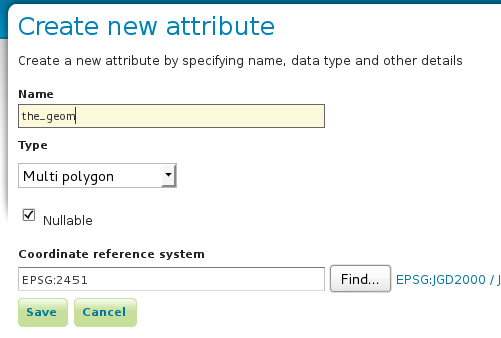 g 「Create new attribute」ページに次のように入力して「Save」ボタンをクリックします。
Name: the_geom
Type: Multi polygon
Coordinate reference system: EPSG:2451
h 「Create new vector layer」ページの「Type name」欄に「akiruno_polygon」と入力して「Save」ボタンをクリックします。


j 「Bounding Boxes」の「Native Bounding Box」の各欄に次のように入力します。(map オブジェクトの maxExtent より)
Min X: -63100
Min Y: -34500
Max X: -45400
Max Y: -24200

(「Feature Type Details」の「Reload feature type」は必要に応じてクリックします。)


n 「Save」ボタンをクリックします。

0 件のコメント:
コメントを投稿