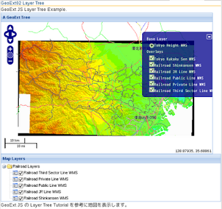
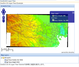
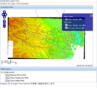
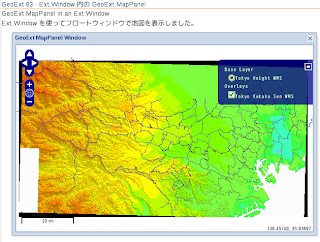
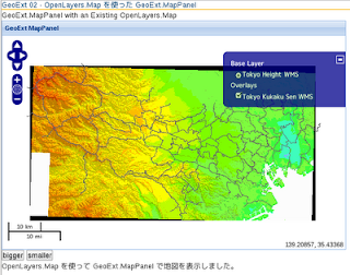
Example サイト
http://www.geoext.org/examples.html
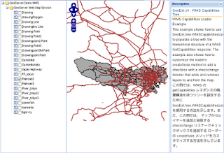
「Layer Node」リンクをクリックすると GeoExt.tree Components が表示されます。
tree.js を参考にします。
説明を意訳すると、GeoExt はLayerContainer や LayerNodes と ExtJS の TreePanel でツリーを作成します。
JS ファイルを新規作成します。
「openlayersTokyoproj」 を右クリックして 新規 -> JavaScript ファイル をクリック。
「JavaScript ファイル」ウィンドウの「ファイル名(任意:tree.js)」に入力して「完了」ボタンをクリック。
GeoExt 05 で使用したレイヤの例を参考に以下のように JavaScript を作成します。
var mapPanel, tree;
Ext.onReady(function() {
 // create a map panel with some layers that we will show in our layer tree
 // below.
 mapPanel = new GeoExt.MapPanel({
  border: true,
  region: "center",
// we do not want all overlays, to try the OverlayLayerContainer
// map: new OpenLayers.Map({allOverlays: false}),
  map: new OpenLayers.Map('map', { // 東京都地図用設定
   controls: [
    new OpenLayers.Control.PanZoom(),
//  new OpenLayers.Control.LayerSwitcher(),
    new OpenLayers.Control.MousePosition(),
    new OpenLayers.Control.ScaleLine()
   ],
   allOverlays: false,
   projection: new OpenLayers.Projection("EPSG:2456"),
   maxResolution: 'auto', //  '183.594', '367.1875',
   maxExtent: new OpenLayers.Bounds(-279000,1054000,-185000,1104000),
   units: 'meters',
   displayProjection: new OpenLayers.Projection("EPSG:4326")
  }),
// center: [146.1569825, -41.6109735],
// zoom: 6,
  layers: [
   new OpenLayers.Layer.WMS( "Tokyo Height WMS",
    "http://192.168.1.6/cgi-bin/mapserv?",
    {
     map: '/home/nob61/mapfile/tokyo_bmi_pgis_img2.map',
     layers: 'height',
//     isBaselayer: true,
     format: 'image/png'
    }
   ),
   new OpenLayers.Layer.WMS( "Tokyo Kukaku Sen WMS",
    "http://192.168.1.6/cgi-bin/mapserv?",
    {
     map: '/home/nob61/mapfile/tokyo_bmi_pgis_img2.map',
     layers: 'kukaku',
     transparent: true,
     format: 'image/png'
    }
   ),
   new OpenLayers.Layer.WMS( "Railroad Shinkansen WMS",
    "http://192.168.1.6/cgi-bin/mapserv?",
    {
     map: '/home/nob61/mapfile/tokyo_pf_pgis.map',
     layers: 'shinkansen',
     transparent: true,
     format: 'image/png'
    },{
     projection: new OpenLayers.Projection("EPSG:4326")
    }
   ),
   new OpenLayers.Layer.WMS( "Railroad JR Line WMS",
    "http://192.168.1.6/cgi-bin/mapserv?",
    {
     map: '/home/nob61/mapfile/tokyo_pf_pgis.map',
     layers: 'jrline',
     transparent: true,
     format: 'image/png'
    },{
     projection: new OpenLayers.Projection("EPSG:4326")
    }
   ),
   new OpenLayers.Layer.WMS( "Railroad Public Line WMS",
    "http://192.168.1.6/cgi-bin/mapserv?",
    {
     map: '/home/nob61/mapfile/tokyo_pf_pgis.map',
     layers: 'publicline',
     transparent: true,
     format: 'image/png'
    },{
     projection: new OpenLayers.Projection("EPSG:4326")
    }
   ),
   new OpenLayers.Layer.WMS( "Railroad Private Line WMS",
    "http://192.168.1.6/cgi-bin/mapserv?",
    {
     map: '/home/nob61/mapfile/tokyo_pf_pgis.map',
     layers: 'privateline',
     transparent: true,
     format: 'image/png'
    },{
     projection: new OpenLayers.Projection("EPSG:4326")
    }
   ),
   new OpenLayers.Layer.WMS( "Railroad Third Sector Line WMS",
    "http://192.168.1.6/cgi-bin/mapserv?",
    {
     map: '/home/nob61/mapfile/tokyo_pf_pgis.map',
     layers: 'thirdsec',
     transparent: true,
     format: 'image/png'
    },{
     projection: new OpenLayers.Projection("EPSG:4326")
    }
   ),
   // create a group layer (with several layers in the "layers" param)
   // to show how the LayerParamLoader works
   new OpenLayers.Layer.WMS("Railroad (Group Layer)",
    "http://192.168.1.6/cgi-bin/mapserv?",
    {
     map: '/home/nob61/mapfile/tokyo_pf_pgis.map',
     layers: [
      "shinkansen",
      "jrline",
      "publicline",
      "privateline",
      "thirdsec"
     ],
     transparent: true,
     format: "image/png"
    }, {
     isBaseLayer: false,
     buffer: 0,
     // exclude this layer from layer container nodes
     displayInLayerSwitcher: false,
     visibility: false
    }
   )
  ]
 });
// create our own layer node UI class, using the TreeNodeUIEventMixin
// TreeNodeUIEventMixin を使用して、独自のレイヤノードのUIクラスを作成
// GeoExt.tree.LayerNodeUI, ... という使い方をする
var LayerNodeUI = Ext.extend(GeoExt.tree.LayerNodeUI, new GeoExt.tree.TreeNodeUIEventMixin());
// using OpenLayers.Format.JSON to create a nice formatted string of the
// configuration for editing it in the UI
// OpenLayers.Format.JSON を使用して、UI で編集するための良くできた書式設定された
// 文字列の設定を作成する
 var treeConfig = new OpenLayers.Format.JSON().write([{
  nodeType: "gx_baselayercontainer" // ベースレイヤツリーノード(固有値)
 }, {
  nodeType: "gx_overlaylayercontainer", // オーバーレイヤツリーノード(固有値)
  expanded: true,
// render the nodes inside this container with a radio button,
// and assign them the group "foo".
// ラジオボタンを使用して、このコンテナ内のノードをレンダリングし、
// それらをグループ "foo" に割り当てることができる。
  loader: {
   baseAttrs: {
    radioGroup: "foo",
    uiProvider: "layernodeui"
   }
  }
 }, {
  nodeType: "gx_layer", // グループレイヤツリーノード(固有値)
  layer: "Railroad (Group Layer)",
  isLeaf: false,
  // create subnodes for the layers in the LAYERS param. If we assign
  // a loader to a LayerNode and do not provide a loader class, a
  // LayerParamLoader will be assumed.
  // レイヤパラメータのレイヤーのサブノードを作成します。
  // LayerNode にローダーを割り当て、ローダークラスを提供しない場合は、
  // LayerParamLoader が仮定されます。
  loader: {
   param: "LAYERS"
  }
 }], true);
 // create the tree with the configuration from above
 // 上記の構成ツリーを作成する
 tree = new Ext.tree.TreePanel({
  border: true,
  region: "west",
  title: "Layers",
  width: 200,
  split: true,
  collapsible: true, // 折りたたみ可
  collapseMode: "mini", // 折りたたみモード
  autoScroll: true,
  plugins: [
   new GeoExt.plugins.TreeNodeRadioButton({
    listeners: {
     "radiochange": function(node) {
      alert(node.text + " is now the active layer.");
     }
    }
   })
  ],
  loader: new Ext.tree.TreeLoader({
   // applyLoader has to be set to false to not interfer with loaders
   // of nodes further down the tree hierarchy
   // applyLoader は、ツリーレイヤのさらに下位ノードのローダーと干渉しないように
   // falseに設定する必要があります
   applyLoader: false,
   uiProviders: {
   // カスタム Ext.tree.TreeNodeUI 実装を指定するプロパティを含むオブジェクト。
   // 返される子ノードのオプション uiProvider 属性が、TreeNodeUI の実装の参照以上の
   // 文字列の場合、その文字列値は uiProviders オブジェクトのプロパティ名として使用される。
    "layernodeui": LayerNodeUI
   }
  }),
  root: {
   nodeType: "async",
   // the children property of an Ext.tree.AsyncTreeNode is used to
   // provide an initial set of layer nodes. We use the treeConfig
   // from above, that we created with OpenLayers.Format.JSON.write.
   // Ext.tree.AsyncTreeNode の子プロパティは、レイヤノードの初期セットを
   // 提供するために使用されています。OpenLayers.Format.JSON.write で作成された
   // 上記から treeConfig を使用します。
   children: Ext.decode(treeConfig)
  },
  listeners: {
   "radiochange": function(node){
    alert(node.layer.name + " is now the the active layer.");
   }
  },
  rootVisible: false,
  lines: false,
  bbar: [{
   text: "Show/Edit Tree Config",
   handler: function() {
    treeConfigWin.show();
    Ext.getCmp("treeconfig").setValue(treeConfig);
   }
  }]
 });
 // dialog for editing the tree configuration
 // ツリー設定を編集するダイアログ
 var treeConfigWin = new Ext.Window({
  layout: "fit",
  hideBorders: true, // 領域間の枠を消す
  closeAction: "hide",
  width: 300,
  height: 400,
  title: "Tree Configuration",
  items: [{
   xtype: "form",
   layout: "fit",
   items: [{
    id: "treeconfig",
    xtype: "textarea"
   }],
   buttons: [{
    text: "Save",
    handler: function() {
     var value = Ext.getCmp("treeconfig").getValue()
     try {
      var root = tree.getRootNode();
      root.attributes.children = Ext.decode(value);
      tree.getLoader().load(root);
     } catch(e) {
      alert("Invalid JSON");
      return;
     }
     treeConfig = value;
     treeConfigWin.hide();
    }
   }, {
    text: "Cancel",
     handler: function() {
      treeConfigWin.hide();
     }
   }]
  }]
 });
 new Ext.Viewport({ // ブラウザ画面全体をパネルで操作
  layout: "fit",
  hideBorders: true,
  items: {
   layout: "border",
   deferredRender: false,
   items: [mapPanel, tree, { // mapPanel と tree ともう一つのウィンドウ
    contentEl: "desc", // div タグの id
    region: "east",
    bodyStyle: {"padding": "5px"},
    collapsible: true,
    collapseMode: "mini",
    split: true,
    width: 200,
    title: "Description"
   }]
  }
 });

});
HTML ファイルを新規作成します。
「openlayersTokyoproj」 を右クリックして 新規 -> HTML ファイル をクリック。
「HTML ファイル」ウィンドウの「ファイル名(任意:geoext06_tree-node.html)」に入力して「完了」ボタンをクリック。
「charset」を「utf-8」にします。
以前使用した OpenLayers.Layer.WMS レイヤの例を参考に以下のように HTML を作成します。
(geoext05_layer-tree.html に tree.js を追加し body タグ内を修正します。)
---
  <title>GeoExt06 Tree Node</title>
---
<!-- tree.js 追加 -->
  <script type="text/javascript" src="./tree.js"></script>

 </head>
 <body>

  <div id="desc">
   <h1 id="title">GeoExt 06 - Tree Node</h1>
   <p id="shortdesc">
    GeoExt.tree Components
   </p>
   <p>This example shows how to work with a layer tree.  The basic
      component for building layer trees is the LayerNode, and there are
      different types of containers for automatically adding a map's
      layers to the tree. The tree configuration of this example is pure
      JSON and can be edited live by clicking on the "Show/Edit Tree Config"
      button below the layers panel.<p>
   <p>この例では、レイヤツリーを動作させる方法を示しています。
       レイヤツリーを構築するための基本的なコンポーネントは、LayerNodeで、
       マップのレイヤーをツリーに自動的に追加するための違った種類のコンテナがあります。
       この例のツリーの設定は、純粋な JSON 形式で、レイヤパネルの下の
       "表示/編集ツリー設定" ボタンをクリックすることでライブ編集することができます。</p>
  </div>

  </body>
</html>

